Get ready for a weekend filled with weather surprises and fluctuations as a front moves back and forth across the tri-state area, bringing about significant changes in temperature and bouts of showers. This classic clash between warm and cool air masses is sure to keep you on your toes, so make sure to have your heavy coat, light jacket, and umbrella handy at all times.
Spotty Showers and Gray Skies
Following a chilly and dry Wednesday, the forecast for the rest of the week is dominated by spotty showers. While no single day is expected to be a complete washout, be prepared for generally gray skies with occasional pockets of rain. The damp weather will also be accompanied by fluctuating temperatures, adding to the unpredictable nature of the upcoming days.
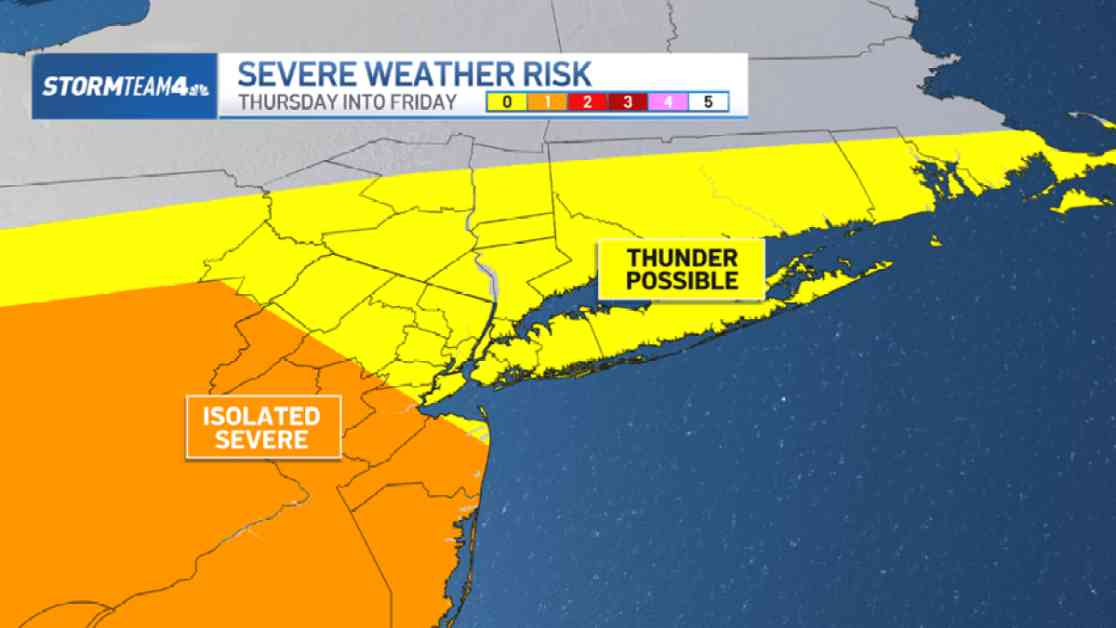
We can expect a significant amount of rain early on Friday, potentially causing disruptions during the morning commute. Heavy rain and isolated thunderstorms are possible, with some areas in central and south Jersey facing the risk of strong damaging gusts. Keep an eye out for ponding on the roads, and if you find yourself caught in a downpour while driving, remember to slow down and maintain a safe distance from other vehicles.
Weekend Weather Swings
As we transition into the weekend, prepare for a shift towards cooler temperatures on Saturday as a new wave of cool air moves in. Highs may struggle to reach 50 degrees, especially in areas north and west of the city where showers are expected to be more prevalent. In contrast, the rain towards the city will be lighter and more scattered, but still enough to potentially disrupt any outdoor plans. Whether you’re going for a run or attending a sporting event, having a rain jacket and umbrella on hand will be essential.
Sunday brings yet another change in the weather pattern, with warm air surging back into the region and pushing highs into the mid-60s. However, scattered shower chances persist, with a break in activity during the morning and afternoon before wet weather returns in the evening and continues into early Monday.
By Monday afternoon, the cold front will finally exit the area, bringing drier conditions but accompanied by a chillier air mass. This transition sets the stage for a quieter, albeit cooler, start to the upcoming week.
As we navigate through these weather fluctuations, it’s important to stay informed and be prepared for sudden changes in the forecast. Keep those essential accessories close by and stay tuned for updates as we navigate through this dynamic weather pattern.


